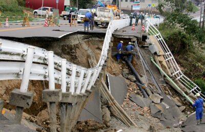
Earthquake Strikes In America’s Heartland

Image source: NationalGeographic.com
A 4.0 earthquake on one of America’s most dangerous faults could be a prelude to a massive upheaval that could devastate large areas of the heartland.
The United States Geological Survey (USGS) confirmed that a 4.0 quake occurred along the New Madrid Seismic Zone near the Arkansas/Missouri state line just before midnight Wednesday night (April 1).
The New Madrid Seismic Zone was the site of one of the most powerful series of earthquakes in American history, in 1811-1812. The then-sparsely populated region was hit by a 7.5 magnitude quake and a 7.0 aftershock on Dec. 16, 2011. That was followed by a 7.3 earthquake on Jan. 23, 1812, and another 7.5 shakeup on Feb. 7, 1812.
The Mississippi River actually ran backwards for part of 1812, and hundreds of smaller quakes continued well into 1813, according to the USGS. The quakes helped created a massive lake in Tennessee called Reelfoot.
A 2008 report from the US Federal Emergency Management Agency (FEMA) stated that a modern New Madrid earthquake would result in “the highest economic losses due to a natural disaster in the United States” and devastate Alabama, Arkansas, Illinois, Indiana, Kentucky, Mississippi, Missouri and Tennessee.
Estimates of the damage from such a quake include:
- The death of 4,000 people in Memphis alone. It’s the nearest major city to the quake.
- Thousands of collapsed bridge.
- Damage to 715,000 buildings.
- Two million people left homeless.
- Some 86,000 people injured.
(NOTE: WAY MORE losses (millions of people dying) than the above has been estimated by numerous scientists, local authorities and certain 'government' agencies, and preparations for that loss have been ongoing, especially in recent months.)
It would disrupt the power and water supply to large areas of the country. To make matters worse, there are nuclear plants throughout the region.
New Rugged Portable Power Unit Will Jump Start Your Car, Power Virtually Anything — And Even Air Up Your Tires!
The energy produced by an earthquake is measured using the Richter magnitude scale of one to 10. The most powerful earthquake ever recorded was a 9.5 magnitude quake that hit Chile in 1960. The quake that devastated Japan in 2011 and caused the Fukushima disaster had a magnitude of 8.9.
The higher the number, the more powerful the quake, because each number on the scare indicates the earthquake is 10 times more powerful. Therefore, the initial quake in 1811 was 35 times more powerful than the April 1 tremor.
No damage was reported from Wednesday’s quake, which was centered around Steele, Missouri, but news reports indicate it was felt as far away as Carbondale, Illinois — nearly 100 miles to the north. The quake was also felt in Memphis and Jackson, Tennessee (the latter of which is about 80 miles to the southeast) and DeSoto County in northern Mississippi, according the USGS.
Why You Should Be Concerned
Although it is not as well-known as California’s San Andreas Fault, the New Madrid Seismic Zone is considered one of America’s most active and dangerous faults. USGS geologists believe that several earthquakes with a magnitude of between seven and eight have occurred on the fault in the last 4,500 years.
Damage from the December 1811 quake was widespread, destroying chimneys and log cabins 400 miles away in Cincinnati. The quake actually rattled windows and furniture in Washington, D.C., and knocked plaster off of houses in Columbia, South Carolina – the latter of which is more than 600 miles away. Highlights from the 1811 quake reported by the USGS include:
- “The earthquakes caused the ground to rise and fall — bending the trees until their branches intertwined and opening deep cracks in the ground.”
- “Deep seated landslides occurred along the steeper bluffs and hillsides; large areas of land were uplifted permanently; and still larger areas sank and were covered with water that erupted through fissures or craterlets.”
- “Huge waves on the Mississippi River overwhelmed many boats and washed others high onto the shore.”
- “High banks caved and collapsed into the river; sand bars and points of islands gave way; whole islands disappeared.”
- The ground literally collapsed in some areas, the USGS estimates that the ground level in some parts of Tennessee and Arkansas dropped by as much as five meters (roughly five yards) during the quake.
- Giant landslides covered more than 80,000 square miles of land in Missouri, Illinois and Tennessee.
It looks as if residents of the Midwest should be as concerned about earthquakes as are people in California.
http://www.offthegridnews.com/grid-threats/earthquake-strikes-in-americas-heartland/


No comments:
Post a Comment